
Skiing in Abruzzo – snow report
The most popular ski resorts, the updated snow report and useful information on how to find lifts or book accommodation for your winter holiday


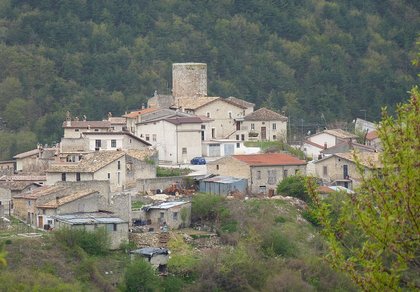
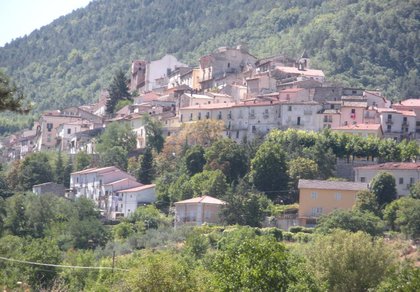
Santa Jona is a hamlet of Ovindoli at 969 metres, on the slopes of the Magnola, in the Sirente-Velino Regional Park. The village grew up around a 13th-century round tower and looks down on the Fucino plain.
The most popular ski resorts, the updated snow report and useful information on how to find lifts or book accommodation for your winter holiday
View the webcams in Abruzzo and check real‑time weather conditions. Some webcams belong to www.abruzzoparchi.it, others are located throughout the region

Weather forecasts for the coming days in Abruzzo. Live weather via our webcams and temperatures recorded in several mountain areas
Maps for trekking, mountain biking, ski touring, running and horse riding. You can also download the GPX track of each route
Abruzzo’s villages are famous for their fortresses, mountains and the traditional trabocchi along the southern coast
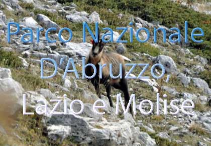
One of Italy’s most famous and oldest national parks
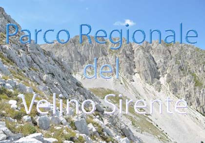
Located in the heart of the Apennines, home to the beautiful villages of the Rocche Plateau
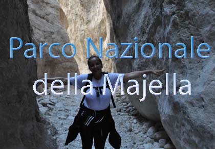
One of the snowiest places in Italy, a unique mountain massif rising close to the sea
Choose between sea or mountains, summer or winter, a sporty holiday or a relaxing one — Abruzzo has it all

Abruzzo is famous for its cuisine, both mountain and coastal, with traditions that vary from area to area
Walks, diving, climbing, mountain biking, horse riding — all outdoor activities available in Abruzzo
A village of just over one hundred and fifty people, on the road that climbs from Celano to Ovindoli. From the square you can see the whole Fucino plain; behind it are Monte Faito and Monte Tino, the Val d’Arano and the Monte Magnola slopes.
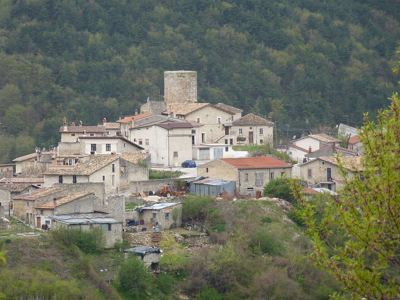
The village lies on the border between the Fucino plain and the Sirente-Velino uplands.
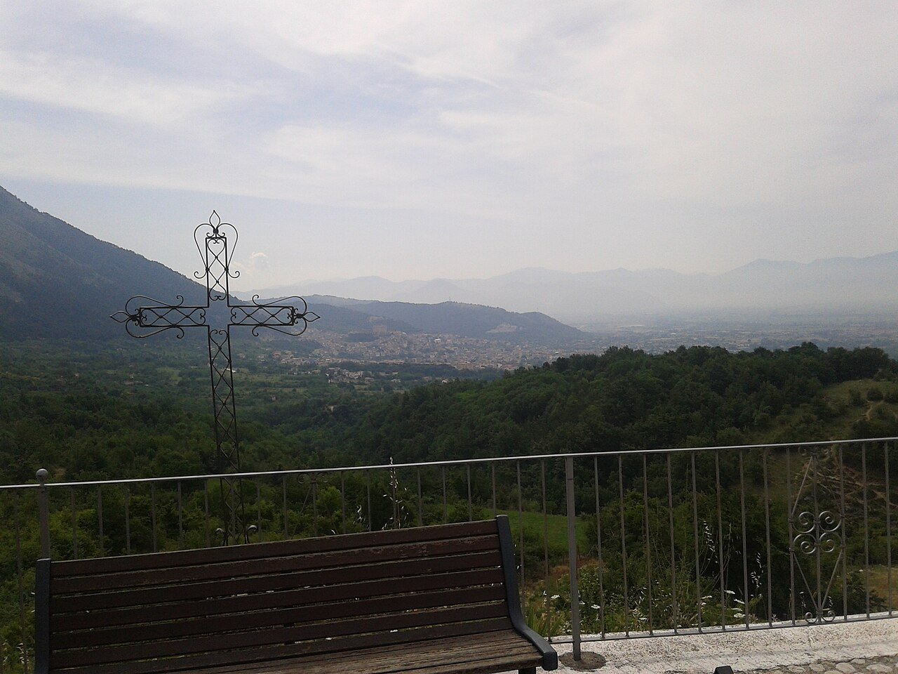
Santa Jona stands at 969 metres on the slopes of the Magnola mountains, overlooked by Monte Faito and Monte Tino (the Serra di Celano). It borders San Potito to the north, the territory of Celano to the south and Forme to the west, and lies entirely within the Sirente-Velino Regional Park.
The name comes from a spring dedicated to Saint Eugenia, near which the first settlement grew: in dialect «Sant’Eugenia» became «Santa Jona», and old documents also spell it «Santa Iona». Until 1811 the village belonged to Celano, then it passed to the municipality of Ovindoli. The 1915 Marsica earthquake brought down the churches and part of the tower; the village was rebuilt in the 20th century.
The round tower, built in the 13th century for Count Tommaso, was a lookout: it was in sight of the towers of Venere and Sperone, the castles of Celano and San Potito and the fortifications of Ovindoli and Rovere. After the 1915 earthquake it was lowered for safety and lost its battlements; at its base is the cistern. Today’s village grew up all around it.
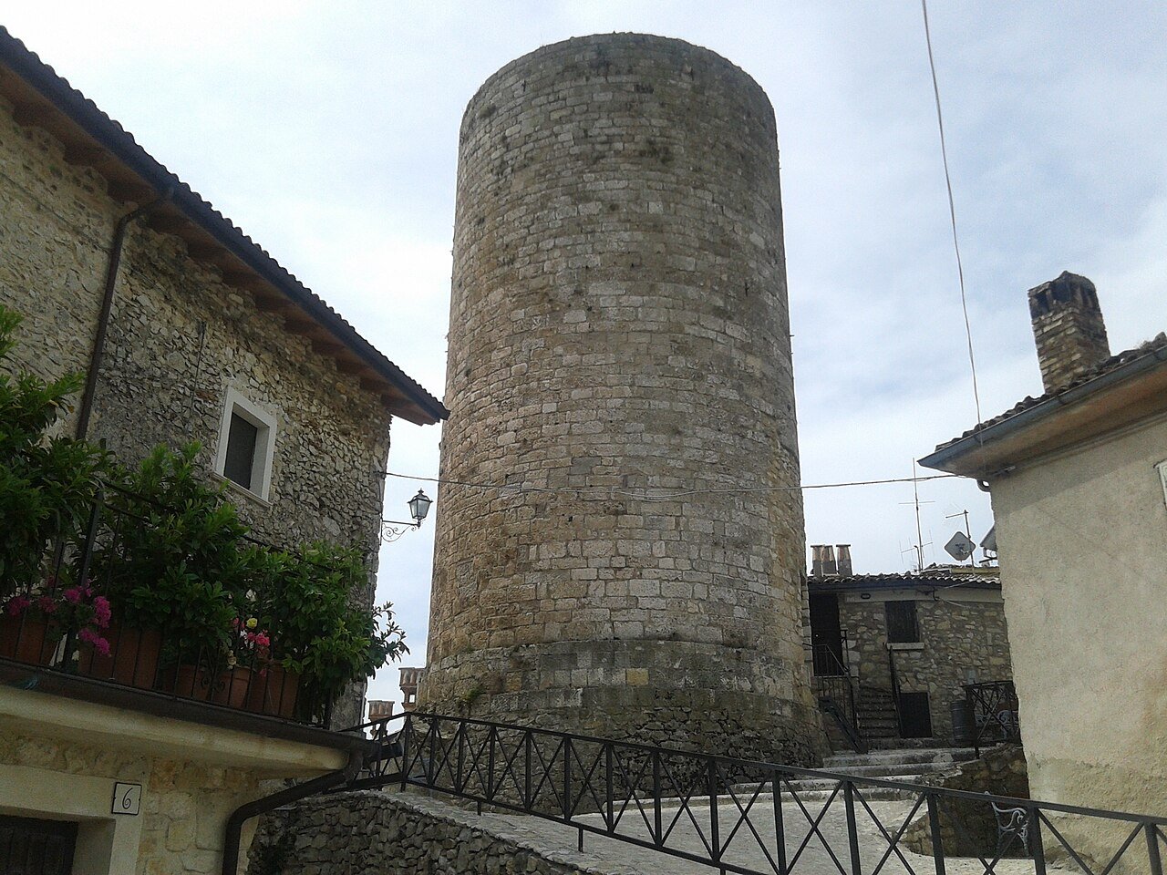
Before the tower there was the «Castrum Sancte Eugenie», built around a 12th-century Norman tower on the Colle Marciano. The village was a small «universitas» with two coats of arms, one showing the saint holding the village in her hand. In the central quarter, inside the medieval walls, stood the church of Santa Eugenia, mentioned as early as the 13th century and destroyed in 1915.
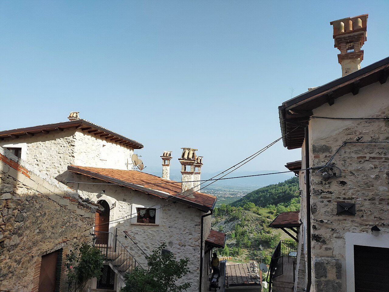
The parish church, in the Colle Marciano district, was rebuilt in 1950 in place of Santa Maria delle Grazie, destroyed by the earthquake. It has a single nave, 16th-century frescoes, the old stone portal and a square bell tower.
North of the village are the remains of an Italic-Roman sanctuary. From the Sant’Eugenia spring ran the aqueduct that carried water to the Roman town of Alba Fucens, through Fonte Capo la Maina and the Arci di Forme. At Calcare di Casalmartino, at 1,166 metres, lie the ruins of the Oretino fortress, built by the counts of the Marsi between the 10th and 11th centuries.
The Santa Jona stream crosses the Val d’Arano and drops, through a series of small waterfalls, into the La Foce stream inside the Celano Gorge. Around the village runs the «Santa Jona loop», a circular walk on the Park’s trails, and from here it is an easy climb to the Pizzo di Ovindoli, the Serra di Celano and Monte Magnola. Some riding stables in the area offer horseback rides. More routes in the Sirente-Velino hiking guide.
The SS696 takes you in about 11 km to the Ovindoli Monte Magnola ski area; continuing via Rocca di Mezzo you reach Campo Felice. Snow and lifts open today in the snow report.
Every year, between the end of August and the first days of September, the village celebrates its patron saint, Saint Eugenia.
The village restaurants serve the food of the Marsica mountains: homemade pasta, grilled meat and arrosticini. From the plain come the Fucino potato and carrot (PGI). More products of the park in Flavours of the parks, all the recipes in traditional Abruzzo cuisine.
Restaurants, farm stay, B&Bs and holiday homes: open the list. For each one address, phone, map and, where available, Tripadvisor.
🔎 Search all of Abruzzo · Data checked on Google Maps, Tripadvisor and the businesses’ websites.
By car: A25 Rome – Pescara motorway, Celano exit, then the SS696 towards Ovindoli: Santa Jona is about 6 km from Celano and 9 from Ovindoli. The SP24 road goes down to Forme and Alba Fucens. Avezzano is about 18 km away, L’Aquila 47. By train: the nearest station is Celano-Ovindoli, on the Rome – Avezzano – Pescara line. Getting around Abruzzo.

Rocca di Mezzo, Rocca di Cambio, Rovere, Terranera, Ovindoli

The Medieval Villages of the Gran Sasso, with their castles, towers, and ancient settlements that once dominated Abruzzo

The village of Cappadocia, in the western part of the Aquilan Abruzzo

The village of Casamaina, a favourite among skiers heading to Campo Felice or Ovindoli

The village of Castel del Monte, the highest settlement in the Gran Sasso area

The village of Civitella Alfedena, in the Abruzzo, Lazio and Molise National Park

Mountaineering on the Gran Sasso, the ideal place for freeride lovers seeking demanding routes

The city of L'Aquila, with its restored Renaissance palaces, a place rich in culture

The 2012 snowfall in L'Aquila brought over one metre of snow in 24 hours — unbelievable images

The village of Pescasseroli, heart of the Abruzzo, Lazio and Molise National Park

The village of Pietracamela, on the north-eastern side of the Gran Sasso, at the foot of Corno Piccolo — a magical and unexpected place

Prati di Tivo, a winter ski resort offering breathtaking views to all who visit

San Domenico and the Serpari ritual, held every first Thursday of May

The 2012 snowfall in Scoppito reached nearly two metres in height

The village of Opi, a splendid settlement in the Abruzzo, Lazio and Molise National Park







Punta Aderci, with the Abruzzese trabocchi stretching from Vasto through Fossacesia to San Vito Chietino


Lake Campotosto, nestled between the Gran Sasso and Monti della Laga ranges, within the national park of the same name

The Capodacqua reservoir, with submerged mills and crystal-clear waters, a paradise for divers

The swimming lake of Scanno, named after the village overlooking it — a place worth visiting

Lake Sinizzo, just a few kilometres from San Demetrio, is the ideal place for nature lovers seeking fresh, clear waters

Lake San Domenico, named after the nearby hermitage; its crystal-clear waters make it unique. Swimming not allowed

The Fountain of the 99 Spouts, a symbol of the city of L'Aquila

The Basilica of Santa Maria di Collemaggio, resting place of Pope Celestine V

The Sanctuary of Madonna d'Appari, set among the rocks along the road between Paganica and Assergi

The Church of San Panfilo, in the municipality of Tornimparte, with its frescoes — a place worth visiting

The Stiffe Caves, inside the Velino-Sirente Regional Park — a magical place to explore
The most popular ski resorts, the updated snow report and useful information on how to find lifts or book accommodation for your winter holiday
Vai
View the webcams in Abruzzo and check real‑time weather conditions. Some webcams belong to www.abruzzoparchi.it, others are located throughout the region
Vai
Weather forecasts for the coming days in Abruzzo. Live weather via our webcams and temperatures recorded in several mountain areas
Vai
Maps for trekking, mountain biking, ski touring, running and horse riding. You can also download the GPX track of each route
Vai
Walks, diving, climbing, mountain biking, horse riding — all outdoor activities available in Abruzzo
Vai
Choose between sea or mountains, summer or winter, a sporty holiday or a relaxing one — Abruzzo has it all
Vai
Abruzzo is famous for its cuisine, both mountain and coastal, with traditions that vary from area to area
Vai
Abruzzo’s villages are famous for their fortresses, mountains and the traditional trabocchi along the southern coast
Vai
One of Italy’s most famous and oldest national parks
Vai
One of Italy’s wildest parks, with typical Apennine landscapes and Dolomite‑like peaks
Vai
Located in the heart of the Apennines, home to the beautiful villages of the Rocche Plateau
Vai
One of the snowiest places in Italy, a unique mountain massif rising close to the sea
Vai