


Majella National Park · UNESCO Global Geopark
A limestone massif with more than 60 peaks, about half of them above 2,000 metres, deep valleys, hermitages in the rock and stone villages. Here you will find the park facts, who to contact and how to get around while respecting the rules.
The ‘mother mountain’ is the mountain of herbs: medicinal plants give centerbe, gentian liqueur and ratafià. At the foot of the massif Sulmona makes confetti and grows red garlic, Fara San Martino makes pasta with its spring water, Lama dei Peligni sfogliatelle, Guardiagrele ‘sise delle monache’; on the plateaus scamorza is made.
🍽️ The park’s flavours: produce, dishes, festivals and where to eat
Nature and territory
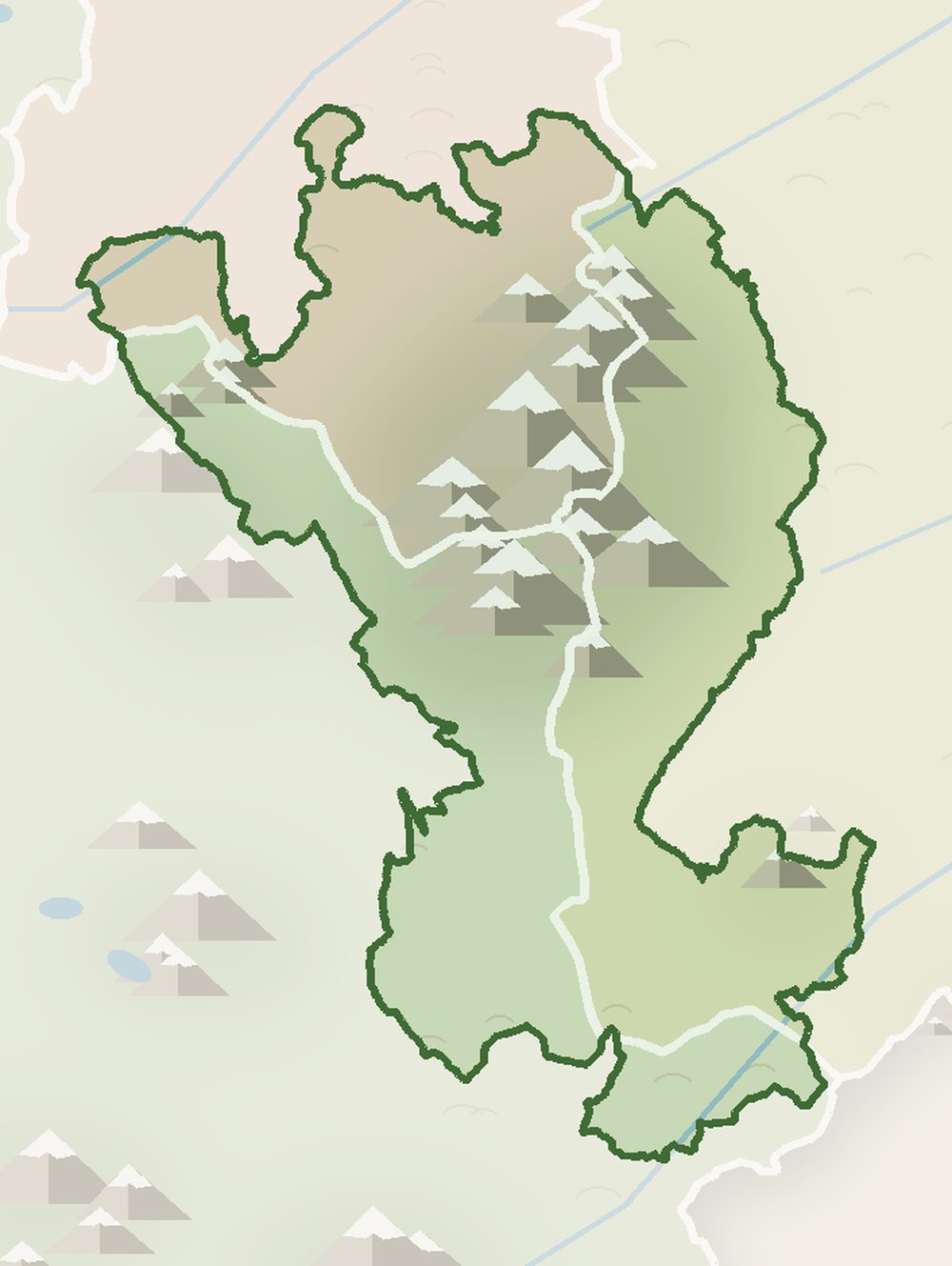
The Majella National Park was established by the Italian framework law on protected areas (394/1991); the Park Authority was set up in 1995. It covers the Majella massif, the Morrone, the Monti Pizzi and the Porrara.
The highest peak is Monte Amaro (2,793 m), the second highest in the Apennines after Corno Grande. Since 2021 the park has been a UNESCO Global Geopark for its geological history: an ancient uplifted carbonate platform with fossils, caves, gorges and karst plateaus.
Park Authority
Palazzo di Sciascio, Via Occidentale 6, 66016 Guardiagrele (CH)
Tel. +39 0864 25701
Fax +39 0864 2570200
Badia Morronese, Via Badia 28, 67039 Sulmona (AQ)
Tel. +39 0864 25701
Fax +39 0864 2570450. Administrative and technical offices.
Via del Vivaio, 65023 Caramanico Terme (PE)
Tel. +39 0864 2570331
Scientific research, botany and wildlife monitoring.
Email info@parcomajella.it · certified email pnm@pec.parcomaiella.it · e-invoices fatturepnm@legalmail.it. Offices open Monday, Wednesday and Friday 9am–1pm; Tuesday and Thursday 9am–1pm and 2:30–5pm.
Official website: parcomajella.it
Mountain emergencies: 112 or 118 (also for mountain rescue).
Visiting the park
Opening times change with the seasons: call before you go.
Caramanico Terme (PE)
Nature museum and otter enclosure. This is where you register to enter the Orfento Valley.
Lama dei Peligni (CH)
Nature and archaeology museum, chamois enclosure and the “Michele Tenore” botanical garden.
Sant'Eufemia a Maiella (PE)
Plants of the Majella, including endemic species.
Palena (CH)
Fossils and geology of the Majella, to understand the Geopark.
Palazzo Tonno, Pacentro (AQ)
Information on the Morrone side and the Peligna Valley.
Palazzo Nanni, Campo di Giove (AQ)
Information on the southern side and the ascent of Monte Amaro.
Gamberale (CH)
Woodland enclosure with red deer.
Other information points in Rocca Pia, Bolognano, San Valentino in Abruzzo Citeriore, Cansano, Montenerodomo, Roccamorice and Serramonacesca.
Before you go
Orfento Valley (Caramanico Terme ordinance no. 36 of 22/06/2026): free, compulsory registration at the Visitor Centre; no entry from the Ponte di Caramanico; the Scalelle trail is one-way, from the Visitor Centre towards the Ponte di Caramanico, and closed in the rain; dogs on a lead (max 1.5 m) with a muzzle to hand. Some sections towards the Ponte della Pietra are still closed after the storms of April 2026.
Before every hike, check the list of open trails on the park website. Open trails (Majella Park)
Staying up high
| Hut | Altitude | Status |
|---|---|---|
| Rifugio Pomilio (Majelletta) | 1,888 m | closed |
| Rifugio Di Marco (Monte Morrone) | 1,747 m | open, unstaffed |
| Rifugio Martellese | 2,035 m | closed |
| Bivacco Fusco | 2,455 m | open (rebuilt in 2019) |
| Bivacco Manzini | 2,523 m | barely usable |
| Bivacco Pelino (summit of Monte Amaro) | 2,793 m | not usable as a shelter |
There are no staffed huts high up on the Majella: multi-day treks must be planned with overnight stays in the valleys. Data as of October 2026.
Towns and culture
The “stone town”, the park's registered office and home of the goldsmith Nicola da Guardiagrele. Guardiagrele
Spa town and gateway to the Orfento Valley, with the Visitor Centre and the scientific office. Orfento Valley
The pasta town, at the foot of the San Martino Gorges. The gorges
Hilltop village on the northern side, with the wolf area; close to the ski slopes in winter. Pretoro · Skiing on the Majella
One of the “Most Beautiful Villages in Italy”, dominated by the towers of the Caldora castle.
Village of the Celestinian hermitages: San Bartolomeo in Legio and Santo Spirito a Majella. 3-day trek
Houses carved into the rock below the cliffs of the eastern Majella. 3-day trek
The chamois village, with the Visitor Centre and the botanical garden.
Bear museum and geopalaeontological museum, on the road to the Forchetta pass.
Mountain resort on the southern side, a base for Monte Amaro.
Botanical garden; state road 487 climbs from here to Passo San Leonardo. Passo San Leonardo
Historic town at the foot of the Morrone; the park's operational office is at the Badia Morronese.
Trails and activities
Three days on the Majella: three versions of the itinerary (classic, easy and high-level), with checked data and alternatives to closed sections.
Go to the 3-day trek →
Our pages on the Majella, with routes, technical data and maps:
Through the year
| Event | Period | Location | Source |
|---|---|---|---|
| Guided excursions of the Park (Official guides) | All year round | Various locations in the Park | Parco Majella |
| Geo Summer / Geo Trek – UNESCO Geopark | Summer | Geosites of the Park | Parco Majella |
| The Farchie of Fara Filorum Petri | 16 January | Fara Filorum Petri | SullaMajella |
| Majella Ethnofestival | Late July | San Valentino in A.C. | SullaMajella |
| Majella Literary Prize | Mid July (18 July 2026) | Abbateggio | SullaMajella |
| Spelt Festival | Mid-August | Abbateggio | SullaMajella |
| Feast of Saint Bartholomew | 25 August | Roccamorice | SullaMajella |
| Adventure Park, Via Ferrata, Orienteering, Bike Park | Seasonal (spring–autumn) | Guardiagrele | Parco Naturale Majella |
Downloads
The trails were downloaded from the Majella National Park website: always follow the official directions and the list of open trails. Open trails (Majella Park).
Data checked in October 2026 against official Park Authority and municipal sources. Opening times and trail status may change: always check before you go.
The Majella National Park on one page: park facts, Park Authority offices and contacts, visitor centres and wildlife areas, rules, huts and bivouacs, villages, links to our Majella pages and a three-day trek.
🗺️ GPX tracks of the trails: download them and see them on the map 🏘️ The villages of the Majella National Park 🧀 What to eat in the park
⚠ Safety: what you need and legal requirements

The Orfento Valley is one of the wildest and most fascinating areas of the Majella National Park
Passo Lanciano and the Majelletta-Mammarosa, above Pretoro: the slopes of the Majella National Park among beech woods and views of the Adriatic
Between the Majella and the Morrone, the starting point for hiking, snowshoeing, ski touring, horse riding and the climb to Monte Amaro

Campo Felice, a ski resort in Abruzzo, offers numerous ski lift facilities. It can be accessed from Lucoli or Rocca di Cambio. In summer, the downhill routes can be enjoyed by mountain bike.

Ovindoli, a ski resort in Abruzzo, features numerous ski lift facilities. The station can be reached from Rocca di Mezzo or Celano.

The ski facilities of Campo Imperatore are located 15 minutes by car from the city of L’Aquila, the highest station in the Apennines. Access is via the cable car from Fonte Cerreto.

In southern Abruzzo, on the border of the Abruzzo National Park, lies the large ski area composed of the slopes of Roccaraso, Rivisondoli and Pescasseroli.
Passo Lanciano and the Majelletta-Mammarosa, above Pretoro: the slopes of the Majella National Park among beech woods and views of the Adriatic

The most popular ski resorts, the updated snow report and useful information on how to find lifts or book accommodation for your winter holiday
View the webcams in Abruzzo and check real‑time weather conditions. Some webcams belong to www.abruzzoparchi.it, others are located throughout the region

Weather forecasts for the coming days in Abruzzo. Live weather via our webcams and temperatures recorded in several mountain areas
Maps for trekking, mountain biking, ski touring, running and horse riding. You can also download the GPX track of each route
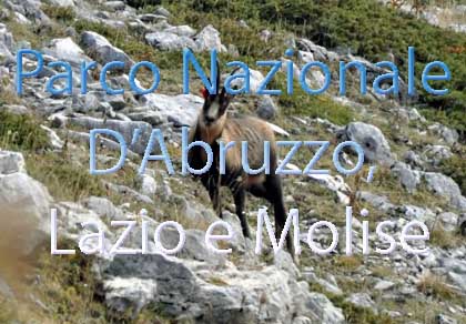
One of Italy’s most famous and oldest national parks
Located in the heart of the Apennines, home to the beautiful villages of the Rocche Plateau
One of the snowiest places in Italy, a unique mountain massif rising close to the sea
Abruzzo’s villages are famous for their fortresses, mountains and the traditional trabocchi along the southern coast
Choose between sea or mountains, summer or winter, a sporty holiday or a relaxing one — Abruzzo has it all

Abruzzo is famous for its cuisine, both mountain and coastal, with traditions that vary from area to area
Walks, diving, climbing, mountain biking, horse riding — all outdoor activities available in Abruzzo
The most popular ski resorts, the updated snow report and useful information on how to find lifts or book accommodation for your winter holiday
Vai
View the webcams in Abruzzo and check real‑time weather conditions. Some webcams belong to www.abruzzoparchi.it, others are located throughout the region
Vai
Weather forecasts for the coming days in Abruzzo. Live weather via our webcams and temperatures recorded in several mountain areas
Vai
Maps for trekking, mountain biking, ski touring, running and horse riding. You can also download the GPX track of each route
Vai
Walks, diving, climbing, mountain biking, horse riding — all outdoor activities available in Abruzzo
Vai
Choose between sea or mountains, summer or winter, a sporty holiday or a relaxing one — Abruzzo has it all
Vai
Abruzzo is famous for its cuisine, both mountain and coastal, with traditions that vary from area to area
Vai
Abruzzo’s villages are famous for their fortresses, mountains and the traditional trabocchi along the southern coast
Vai
One of Italy’s most famous and oldest national parks
Vai
One of Italy’s wildest parks, with typical Apennine landscapes and Dolomite‑like peaks
Vai
Located in the heart of the Apennines, home to the beautiful villages of the Rocche Plateau
Vai
One of the snowiest places in Italy, a unique mountain massif rising close to the sea
Vai