
Skiing in Abruzzo – snow report
The most popular ski resorts, the updated snow report and useful information on how to find lifts or book accommodation for your winter holiday


Tracks of the routes we describe on the site, grouped by area. For each one you will find length, ascent, lowest and highest point, where the track comes from and our page with the description.
⚠ Safety: what you need and legal requirements
The most popular ski resorts, the updated snow report and useful information on how to find lifts or book accommodation for your winter holiday
View the webcams in Abruzzo and check real‑time weather conditions. Some webcams belong to www.abruzzoparchi.it, others are located throughout the region
Weather forecasts for the coming days in Abruzzo. Live weather via our webcams and temperatures recorded in several mountain areas
Maps for trekking, mountain biking, ski touring, running and horse riding. You can also download the GPX track of each route
Abruzzo’s villages are famous for their fortresses, mountains and the traditional trabocchi along the southern coast
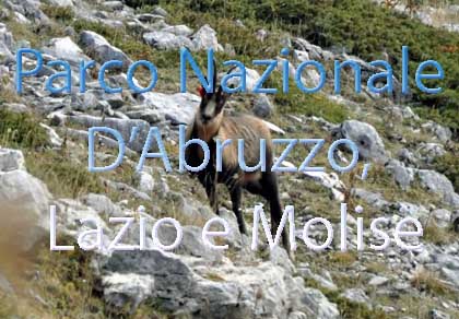
One of Italy’s most famous and oldest national parks
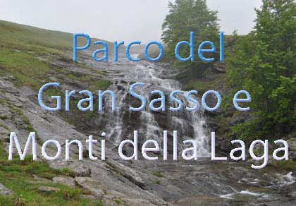
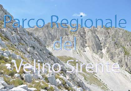
Located in the heart of the Apennines, home to the beautiful villages of the Rocche Plateau
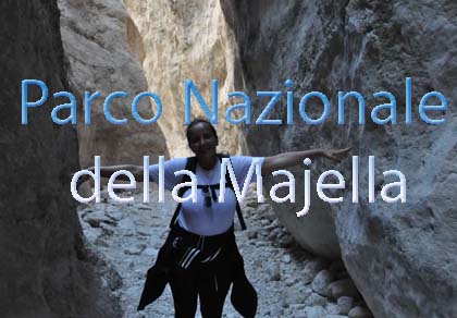
One of the snowiest places in Italy, a unique mountain massif rising close to the sea
Choose between sea or mountains, summer or winter, a sporty holiday or a relaxing one — Abruzzo has it all

Abruzzo is famous for its cuisine, both mountain and coastal, with traditions that vary from area to area
Walks, diving, climbing, mountain biking, horse riding — all outdoor activities available in Abruzzo

Rocca di Mezzo, Rocca di Cambio, Rovere, Terranera, Ovindoli

The Medieval Villages of the Gran Sasso, with their castles, towers, and ancient settlements that once dominated Abruzzo

The village of Cappadocia, in the western part of the Aquilan Abruzzo

The village of Casamaina, a favourite among skiers heading to Campo Felice or Ovindoli

The village of Castel del Monte, the highest settlement in the Gran Sasso area

The village of Civitella Alfedena, in the Abruzzo, Lazio and Molise National Park

Mountaineering on the Gran Sasso, the ideal place for freeride lovers seeking demanding routes

The city of L'Aquila, with its restored Renaissance palaces, a place rich in culture

The 2012 snowfall in L'Aquila brought over one metre of snow in 24 hours — unbelievable images

The village of Pescasseroli, heart of the Abruzzo, Lazio and Molise National Park

The village of Pietracamela, on the north-eastern side of the Gran Sasso, at the foot of Corno Piccolo — a magical and unexpected place

Prati di Tivo, a winter ski resort offering breathtaking views to all who visit

San Domenico and the Serpari ritual, held every first Thursday of May

The 2012 snowfall in Scoppito reached nearly two metres in height

The village of Opi, a splendid settlement in the Abruzzo, Lazio and Molise National Park










Punta Aderci, with the Abruzzese trabocchi stretching from Vasto through Fossacesia to San Vito Chietino


Lake Campotosto, nestled between the Gran Sasso and Monti della Laga ranges, within the national park of the same name

The Capodacqua reservoir, with submerged mills and crystal-clear waters, a paradise for divers

The swimming lake of Scanno, named after the village overlooking it — a place worth visiting

Lake Sinizzo, just a few kilometres from San Demetrio, is the ideal place for nature lovers seeking fresh, clear waters

Lake San Domenico, named after the nearby hermitage; its crystal-clear waters make it unique. Swimming not allowed

The Fountain of the 99 Spouts, a symbol of the city of L'Aquila

The Basilica of Santa Maria di Collemaggio, resting place of Pope Celestine V, the only pope buried outside Rome’s walls

The Sanctuary of Madonna d'Appari, set among the rocks along the road between Paganica and Assergi

The Church of San Panfilo, in the municipality of Tornimparte, with its frescoes — a place worth visiting

The Stiffe Caves, inside the Velino-Sirente Regional Park — a magical place to explore
Tracks of the routes we describe on the site, grouped by area. For each one you will find length, ascent, lowest and highest point, where the track comes from and our page with the description.
Tap «Show on the map» on a card, or a point on the map, to see the route: green is the start, red the finish.
✔ Track recorded by abruzzoparchi.it
✔ Track recorded by abruzzoparchi.it
✔ Track recorded by abruzzoparchi.it
✔ Track recorded by abruzzoparchi.it
✔ Track recorded by abruzzoparchi.it
✔ Track recorded by abruzzoparchi.it
✔ Track recorded by abruzzoparchi.it
Source: CAI trail network on OpenStreetMap, where the track was taken from · CAI trail no. CGS3 · managed by: Il Cammino del Gran Sasso · OpenStreetMap relation 17247273
© OpenStreetMap contributors, ODbL licence. Length and ascent: trail register; altitudes: EU-DEM terrain model (OpenTopoData).
Source: CAI trail network on OpenStreetMap, where the track was taken from · CAI trail no. SI · managed by: CAI Sez. di Teramo · OpenStreetMap relation 7424361
© OpenStreetMap contributors, ODbL licence. Length and ascent: trail register; altitudes: EU-DEM terrain model (OpenTopoData).
Source: CAI trail network on OpenStreetMap, where the track was taken from · CAI trail no. 105 · managed by: Club Alpino Italiano · OpenStreetMap relation 7383834
© OpenStreetMap contributors, ODbL licence. Length and ascent: trail register; altitudes: EU-DEM terrain model (OpenTopoData).
Source: CAI trail network on OpenStreetMap, where the track was taken from · CAI trail no. 152 · managed by: Club Alpino Italiano · OpenStreetMap relation 7385357
© OpenStreetMap contributors, ODbL licence. Length and ascent: trail register; altitudes: EU-DEM terrain model (OpenTopoData).
✔ Track recorded by abruzzoparchi.it
✔ Track recorded by abruzzoparchi.it
✔ Track recorded by abruzzoparchi.it
✔ Track recorded by abruzzoparchi.it
✔ Track recorded by abruzzoparchi.it
✔ Track recorded by abruzzoparchi.it
✔ Track recorded by abruzzoparchi.it
✔ Track recorded by abruzzoparchi.it
Source: CAI trail network on OpenStreetMap, where the track was taken from · CAI trail no. P · OpenStreetMap relation 9837073
© OpenStreetMap contributors, ODbL licence. Length and ascent: trail register; altitudes: EU-DEM terrain model (OpenTopoData).
Source: CAI trail network on OpenStreetMap, where the track was taken from · CAI trail no. H1 · OpenStreetMap relation 9812312
© OpenStreetMap contributors, ODbL licence. Length and ascent: trail register; altitudes: EU-DEM terrain model (OpenTopoData).
Source: CAI trail network on OpenStreetMap, where the track was taken from · CAI trail no. O2 · OpenStreetMap relation 9814777
© OpenStreetMap contributors, ODbL licence. Length and ascent: trail register; altitudes: EU-DEM terrain model (OpenTopoData).
✔ Track recorded by abruzzoparchi.it
✔ Track recorded by abruzzoparchi.it
✔ Track recorded by abruzzoparchi.it
✔ Track recorded by abruzzoparchi.it
✔ Track recorded by abruzzoparchi.it
✔ Track recorded by abruzzoparchi.it
Source: CAI trail network on OpenStreetMap, where the track was taken from · CAI trail no. 14A · OpenStreetMap relation 9857764
© OpenStreetMap contributors, ODbL licence. Length and ascent: trail register; altitudes: EU-DEM terrain model (OpenTopoData).
Source: CAI trail network on OpenStreetMap, where the track was taken from · CAI trail no. 1 · OpenStreetMap relation 10479583
© OpenStreetMap contributors, ODbL licence. Length and ascent: trail register; altitudes: EU-DEM terrain model (OpenTopoData).
✔ Track recorded by abruzzoparchi.it
✔ Track recorded by abruzzoparchi.it
Source: CAI trail network on OpenStreetMap, where the track was taken from · CAI trail no. Y3 · OpenStreetMap relation 16344773
© OpenStreetMap contributors, ODbL licence. Length and ascent: trail register; altitudes: EU-DEM terrain model (OpenTopoData).
Source: CAI trail network on OpenStreetMap, where the track was taken from · CAI trail no. L1 · OpenStreetMap relation 9684220
© OpenStreetMap contributors, ODbL licence. Length and ascent: trail register; altitudes: EU-DEM terrain model (OpenTopoData).
✔ Track recorded by abruzzoparchi.it
✔ Track recorded by abruzzoparchi.it
Open the file in the app you use for walking (for example OsmAnd, Locus Map, Gaia GPS or Wikiloc) or on a computer with GPXSee. Tracks help you find your way but do not replace waymarks, a map and your own judgement of conditions: trails change with landslides, snow and works.
Our tracks: recorded by us along the routes described on the site. CAI tracks: from the numbered trail network of the Italian Alpine Club on OpenStreetMap, also maintained by the CAI; checked in October 2026.
The most popular ski resorts, the updated snow report and useful information on how to find lifts or book accommodation for your winter holiday
Vai
View the webcams in Abruzzo and check real‑time weather conditions. Some webcams belong to www.abruzzoparchi.it, others are located throughout the region
Vai
Weather forecasts for the coming days in Abruzzo. Live weather via our webcams and temperatures recorded in several mountain areas
Vai
Maps for trekking, mountain biking, ski touring, running and horse riding. You can also download the GPX track of each route
Vai
Walks, diving, climbing, mountain biking, horse riding — all outdoor activities available in Abruzzo
Vai
Choose between sea or mountains, summer or winter, a sporty holiday or a relaxing one — Abruzzo has it all
Vai
Abruzzo is famous for its cuisine, both mountain and coastal, with traditions that vary from area to area
Vai
Abruzzo’s villages are famous for their fortresses, mountains and the traditional trabocchi along the southern coast
Vai
One of Italy’s most famous and oldest national parks
Vai
One of Italy’s wildest parks, with typical Apennine landscapes and Dolomite‑like peaks
Vai
Located in the heart of the Apennines, home to the beautiful villages of the Rocche Plateau
Vai
One of the snowiest places in Italy, a unique mountain massif rising close to the sea
Vai